
The history of North Hatley

Bilingual village of 632 inhabitants incorporated on October 25, 1897. Many of the early settlers around North Hatley were Loyalists, mostly farmers, who left New England in the years following the declaration of American independence in 1776.
The village, north of Hatley Township, was established in 1803. The municipality of North Hatley was incorporated in 1897. The name refers to the parish of Hatley, located in Cambridgeshire, south-east England. The village owes most of its grand houses and distinctive architecture to its first aristocrats, mainly Americans from south of the Mason-Dixon line.
Discover the services and businesses
in North Hatley and area
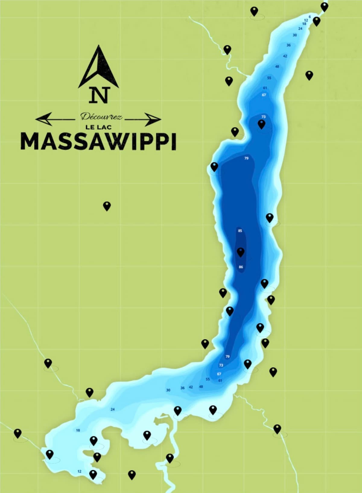
Lake Massawippi
Lac Massawippi is a body of water whose mouth is located in the municipality of Sainte-Catherine-de-Hatley, in the regional county municipality (RCM) of Memphrémagog, in the Estrie administrative region of Quebec, Canada.
The Massawippi River (length: 20 km), which empties into the Saint-François River at Lennoxville, is the outflow of Lake Massawippi. At its southern end, Lake Massawippi collects the waters of the Tomifobia River.
The lake is shaped like a seahorse. It has a surface area of 15 km² and a maximum depth of 75 m. Its mouth is located to the northeast of the lake.
The lake is bordered by five municipalities:
- North Hatley,
- Hatley (township municipality),
- Hatley,
- Ayer’s Cliff,
- Sainte-Catherine-de-Hatley,
Characteristics:
- Area 18 km2
- Length 14.2 km
- Width 1.9 km
- Altitude 161 m
- Depth
– Maximum 85.7 m
– Average 75 m